- November 2, 2021
- Posted by: juliaHDG
- Category: Blog
Smart security cameras use video analytics to detect intruders by automatically “seeing” movement and sending alerts. While this solution works quite well in stable, indoor environments, just imagine what a smart camera must contend with outdoors – where everything moves, all the time! Trees sway in the wind, debris blows across the ground, small animals cross the camera’s field of view – all this movement has to be ignored by the camera, or it will send hundreds of false alarms to the monitoring center.
And of course, in the middle of all this movement, the bad guy must be detected, every time, and without fail.
At one time, smart cameras used outdoors led to great disappointment due to excessive nuisance alarms or outright misdetects. Yet many of today’s smart outdoor cameras are able to protect sites like substations, transportation sites, and fenced yards where lucrative materials are vulnerable to theft with very good reliability, even with the challenges. And one of the important strategies these successful systems use to reduce nuisance alarms and catch intruders is known as geo-enabled video analytics.
What is geo-registration, and how does it empower detection performance?
Essentially, geo-enabled video analytics work by correlating every pixel generated by the sensor to a point on an internal GPS map of the area under security management. When a camera understands this information, it gives the analytic software inside the camera highly reliable intelligence about the actual size, location, and bearing of all objects in the field of view. From there, very accurate analytic rules can be created to greatly improve detection performance.
You might be asking – how does knowing the actual size and location of an object empower detection performance?
Consider how human vision works: Our eyes give us depth perception – we can look at an outdoor scene and easily tell which objects are close or far, based on their relative size from each other.
Now imagine closing one eye and looking at the same scene. You would lose your sense of depth, the scene would flatten out, and you would have a hard time determining where things are in relation to each other.
It’s the same with a “one-eyed” camera – unless it’s geo-enabled.
Essentially, this approach creates a three-dimensional capability for an outdoor detection camera. For example, to a smart camera, a small animal in the near field will look much larger than a man hundreds of meters away, as you can see in the figure below.
For example, to a smart camera, a small animal in the near field will look much larger than a man at 300 meters away, as you can see in the figure below.

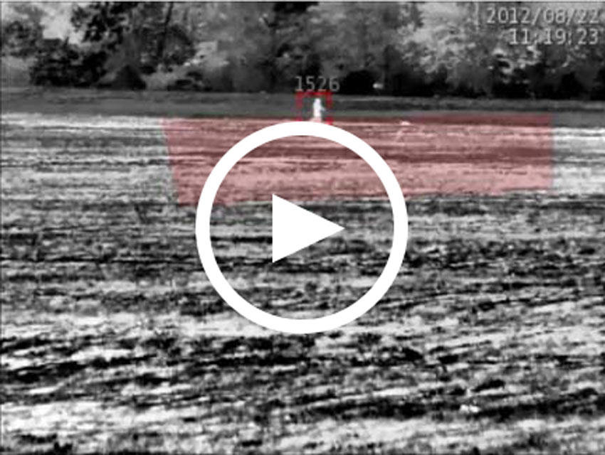
A smart camera needs to ignore the dog while alerting you to the person in the distance, even though the animal will cover more of the camera’s field of view. The same criteria applies to other moving things which are always present outdoors.
Here’s a real-world example of geo-registration video analytics at work, detecting the person but ignoring the dog.
With a camera that is geo-enabled, such non-security related movement can be ignored and the camera won’t send needless alarms, because it “knows” that the small object is actually six feet and represents a likely intruder, while the dog, while closer and taking up more of the screen, is actually three feet and likely an animal. So the camera will ignore the dog, and detect the person, and the security team charged with protecting site will trust that an alarm triggered is credible, and that a response is urgent.
The Role of Video Processing for Geo-Enabled Analytics
It’s important to understand that not every smart camera use geo-location. This is because making a camera geo-enabled is a highly processing-intensive task. A camera must process many millions of bits of data every second, day and night, over large areas typical of most perimeters, and calculate the geo-location of every pixel in the scene. And the system must do this while streaming many frames per second.
This is where recent innovations in video processing plays a role. Geo-enabled cameras take advantage of today’s highly capable video processors – at the edge, inside the camera, and in advance of the video analysis – to turn video sensors cameras into reliable intruder detectors. Only cameras with very powerful image processing are up to the task.
Making Geo-Registered Analytics Easy
While geo-registration sounds like a complicated process, activating the capability is surprisingly easy. SightSensors are geo-registered when first installed using a very simple auto-calibration that reduces complexity to a single click.
When you first configure a SightSensor, generally all you need to do is enter the camera’s height off the ground and click a button. From there, sensors built into the camera will automatically determine its tilt and yaw. This gives the camera three data points – height, tilt, and yaw – from which to calculate the geo-location of each pixel.

Geospatial Video Analytic Detection Benefits
Geo-enabled analytics are an important capability from which many benefits flow.
For one, they vastly improve the SightSensor’s intruder detection reliability. When the camera knows the actual size and location of all objects, they can detect a human-sized object but ignore objects that are not human sized. This automatically eliminates small animals and other distractions from triggering alarms.
Geo-registration can also be used as a powerful security policy tool by creating geospatial detection zones.
Many smart cameras will assign a “tripwire” in the scene; when an intruder crosses this line, an alarm is triggered.
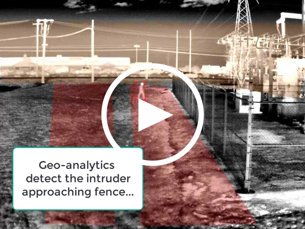
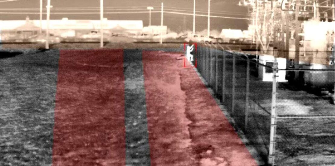
Geospatial analytics go significantly further, allowing you to set zones of detection based on real-world activities – speed, bearing, and geo-location. With this capability, you can create:
- Flexible security policies with geospatial “From-To Zones” that detect people outside the fence only when they move towards the perimeter, which represents a threat – while ignoring those inside the fence, which are not a danger.
- Layers of protection. You can place a buffer zone at the fence and also around select, important assets like a control house at a substation, while allowing other traffic to flow unimpeded.
- Geospatial mask zones can ignore areas of high traffic from triggering unwanted signals, like highway cars passing outside the fence.
Geo-registration and Hands-free PTZ Control
Another benefit of knowing the geo-registered “whereabouts” of an object outdoors is the ability to automatically direct pan-tilt-zoom (PTZ) cameras to the exact location of an alarm and to zoom and follow a detected target.
Often PTZ cameras are used to watch outdoor areas, but when applied to large areas, a PTZ camera’s narrow field of view relative to the wide areas under surveillance almost guarantees that events will go unnoticed. Trying to manually steer PTZs over outdoor areas is like trying to find a needle in a haystack.
This powerful capability is shown in the video below. The intruder is detected at distance by the dual-sensor SightSensor camera (at left), which direct the SightTracker PTZ to automatically zoom, classify and track the target for up-close detail (at right).
Good decisions depend on accurate detection, and the impact of an event unfolding is directly proportional to a security department’s ability to intercept it quickly. Every second counts. Using cameras that are geo-registered to the scene adds a valuable tool to enable comprehensive security throughout a facility, and provides:
- Excellent 24/7 detection performance in all conditions
- An ability to acquire an intruder’s speed, bearing, and geo-location in milliseconds
- One-click Geospatial Zones – not tripwires – based on size, speed, bearing, and geo-location that greatly reduces false alarms from small animals, blowing trash
- An ability to automatically spin PTZs to zoom and follow a detected target for real-time assessment
- A proven solution that delivers security peace of mind


